+17 °C, +16 °C ... +28 °C Tomorrow:+32 °C
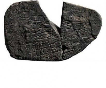
A mysterious stone found by archeology students during a summer dig on the island of Bornholm might be a 5,000-year-old map showing the location of different fields in the nearby area. The stone, which is no more than 5cm long on the longest side, was found by an archeology student during the excavation of a Neolithic shrine at Vasagård on the southern part of the Baltic island. Like them, this stone was found broken in two. Archeologists suspect that the stones may have been deliberately broken as part of a desacralization process at the shrine.
According to the National Museum, the centre of the stone shows corn in well-defined fields, surrounded by fields which have been ploughed ready for sowing. Archeologists are interpreting other marks as fences, trees, and perhaps paths |


MAMUL.am - News from Armenia, Artsakh (Nagorno-Karabakh) and the world
Republication or redistribution of MAMUL.am content is expressly prohibited without the prior written consent.
Address: 1 Charents str., Yerevan, Republic of Armenia.
Tel.: +374 (10) 55-20-59
E-mail: info@mamul.am
Tel.: +374 (91) 99-22-02
E-mail: marketing@mamul.am